

#192: Cloudburst 101 - Systems Thinking for Climate Repair
Episode 1 of the Storm Repatterning Series. A plain-language guide to thresholds, CAPE, and the sequence that breaks the ground.

At first light, the village feels suspended.
A rooster stutters into the pale blue, dogs nose the rising mist.
Then a splash.
A child’s slipper floats past the doorway, brown water following.
The slope is running.
Nobody expected rain last night.
Nobody saw it coming.
Yet the field is drowned, the well choked, the kitchen swept.
No thunder warned them.
No storm moved across the sky.
Just a vertical assault,
half the season’s rain dropped in minutes, hammering one square kilometre like a fist on a drum.
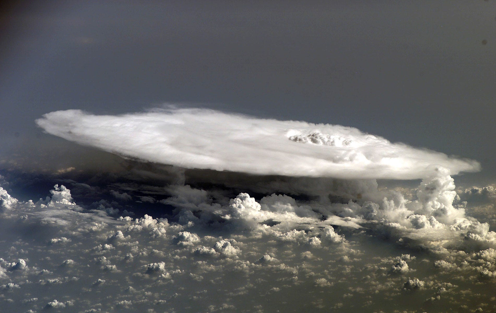
We call it a cloudburst, but the term is not mere poetic flourish. It is a formally recognized event class in hydrometeorology.
1 | What is a Cloud Burst?
A cloudburst is the atmosphere’s version of an over-tightened pressure valve: a sudden vertical release of water from a saturated column, too fast and too focused for the land below to absorb. Defined by the India Meteorological Department (IMD) as ≥ 100 mm of rainfall within an hour over ≤ 30 km², a cloudburst overwhelms terrain, drainage, and sometimes even weather instruments (IMD 2005).
Unlike drifting monsoon fronts or squall lines, cloudbursts are mostly vertical collapses. The rain falls straight down, often with little horizontal spread. Most of the damage comes not from storm movement but from intensity, saturation, and the terrain’s inability to cope.
Meteorologically, cloudbursts belong to the class of explosive convection events, often associated with steep lapse rates, elevated CAPE values, and rapid updraft collapse (MacIlveen, 2010). Radar scans of burst days show cores as narrow as 8–12 km, but with peak intensities of 100–150 mm h⁻¹ sustained for 20–40 minutes (Ghosh et al., 2023). In these conditions, slope failures, flash floods, and infrastructure loss occur with little lead time.
Their frequency is rising.
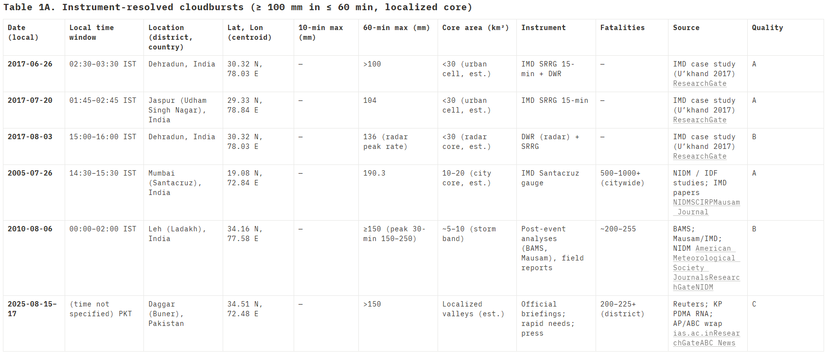
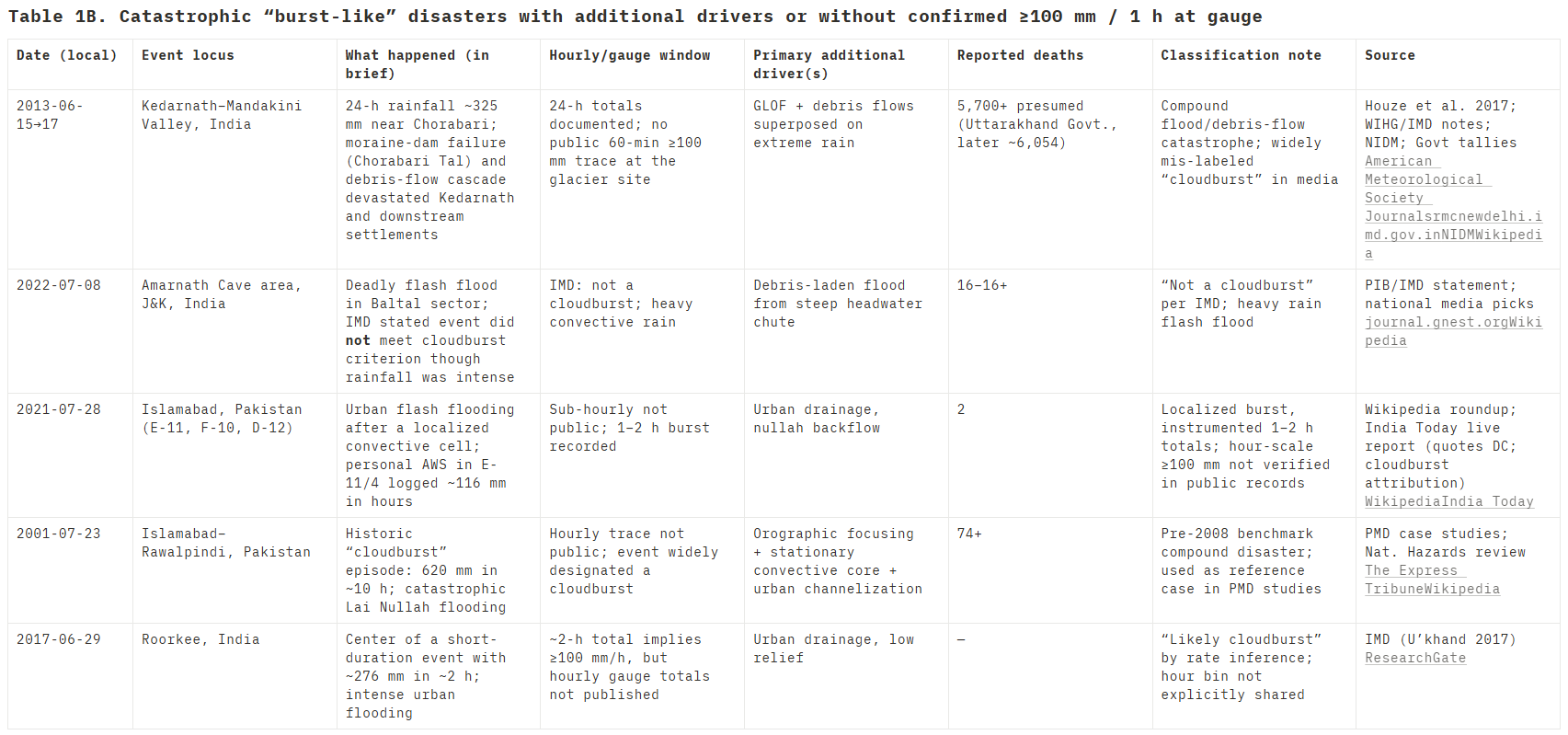
Between 2010 and 2025, over 170 cloudbursts were recorded across India and Pakistan. While many cluster in mountainous zones like Uttarakhand, Himachal, and Swat, bursts have increasingly been recorded in plains cities—Gurugram, Lahore, Nagpur—suggesting a wider atmospheric vulnerability (DownToEarth 2025; Torelló-Sentelles et al., 2024).
The 2008 Islamabad event now reads like a prelude to what would become a more frequent pattern. On July 23rd, a stationary convective cell formed over the northwestern periphery of the city (G-9 to E-11 sectors) triggered by surface heating, local uplift near Margalla Hills, and moisture-rich convergence.
Within one hour, over 140 mm of rain had fallen in some pockets. Eight people died, storm drains overflowed, walls collapsed, and underpasses submerged. PMD bulletins confirmed it as a “deep convective anomaly without frontal or monsoonal influence”, suggesting that even in absence of large-scale systems, thermodynamic instability and landform alignment can provoke violent local collapses.
This raises a key point: cloudbursts are not confined to Himalayan ridges or monsoon-fed catchments. As long as the vertical energy structure aligns i.e., hot ground, cool mid-layer, moist air, anywhere can become a target.
So why is their frequency rising?
Part of the answer lies in land-use change and urbanisation. Cities generate intense sensible heat fluxes, often exceeding +110 W m⁻² compared to vegetated baselines, which lowers the Lifting Condensation Level (LCL) and encourages earlier, stronger cloud development (Sharma et al., 2024). Additionally, aerosol concentrations in urban air modify microphysics by seeding smaller, denser droplets that fall more violently when they coalesce (Du et al., 2024). These factors increase not just the likelihood of a burst, but its rainfall efficiency—how much water the system squeezes into a short window.
That said, many cloudbursts still occur over forests or bare ridges, far from any anthropogenic heat island. In those cases, the trigger comes from large-scale moisture plumes, cold mid-tropospheric lids, and topographic uplift. We'll explore this precisely in Section 2.
For now, the takeaway is this:
Cloudbursts are the atmospheric equivalent of a mechanical failure under load. Too much energy, too quickly. The release is sharp, narrow, and unstoppable once the system tips.
Which brings us to,
What physical steps load the sky with enough energy to burst like that so fast, and in such small places?
2 | Mechanics: Fuel ▸ Trigger ▸ Lift ▸ Burst
A cloudburst is not random. It is the end result of a vertical conversation, between the ground, the sky, and the thresholds in between.
To understand how these events form, we must look at the four ingredients in sequence: fuel, trigger, lift, and collapse. Each one builds pressure into the system. When they align, the sky lets go.
Let's start at the base.
2.1 Fuel: The Moisture Engine
The foundational requirement is moisture. In South Asia, cloudbursts typically ride in on monsoon plumes which are long, warm arms of humid air stretching from the Arabian Sea or Bay of Bengal. These plumes are not uniform. The most dangerous ones carry high equivalent potential temperature (θₑ) values (around 355 K) and contain over 40 mm of precipitable water in the column (Ghosh et al., 2023).