


#98: Proposal for Enhancing Bioprecipitation in Valencia: Strategic Interventions and Detailed Methodology
A possible way to calculating the area required for enhancement of Bio-precipitation.

So, I got a call the other day—nothing out of the ordinary at first. But then came the question that really caught my attention: "Can we do this? Can we actually increase rainfall in Spain and stop the desertification that’s creeping across the land?" It wasn’t just idle curiosity; there was real urgency behind the question.
Spain is facing a crisis that’s hard to ignore. Vast regions of the country, from the sun-drenched fields of Andalusia to the fertile plains of Valencia, are slowly turning into deserts. The numbers are staggering: 74% of Spain is currently undergoing desertification, and by 2100, 18% of the land could become irreversibly arid. These aren’t just remote, barren lands—they include some of the most vital agricultural areas in the country.
Valencia, Andalusia, Almería—these names are synonymous with Spain’s role as one of Europe’s key agricultural hubs, often referred to as the "Bread Basket of Europe." But that status is under threat. Water reserves in places like Catalonia and Andalusia have dropped to as low as 25% of capacity. Overall, in some areas, water stocks are now below 40%. The droughts, driven by broken hydrological cycles, have led to historically low crop yields. This is no small matter—Spain’s agricultural sector consumes 80% of the country’s freshwater and brought in over 50 billion Euros in exports just last year.
The situation is made worse by unsustainable agricultural practices, particularly in regions like Almería. There, intensive greenhouse farming has pushed productivity to its limits, but at a cost: groundwater is being depleted faster than it can be replenished, and the soil is degrading rapidly. These practices, once the backbone of Spain’s agricultural success, are now contributing to the very problem they sought to overcome.
If we don’t act soon, the risks for Spain are not just significant—they’re existential. The country’s reliance on water for agriculture, in the face of increasingly erratic weather patterns and broken cycles, is becoming less viable by the day. Without a major shift in how water is managed—through reforestation, regenerative farming, and innovative conservation methods like fog capture nets—Spain’s agricultural future, and by extension, its economic stability, could be in serious jeopardy.
This call wasn’t just about finding a quick fix. It was about looking at the big picture and figuring out how to turn the tide before it’s too late. And that’s what we’re going to explore next with the focus on Valencia as a first step.
A- Overview
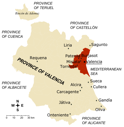
The Valencia region, with its diverse landscapes ranging from coastal plains to mountainous terrain, presents a unique opportunity to enhance bioprecipitation through targeted environmental interventions. Currently, the region experiences significant seasonal variability in rainfall, humidity, and groundwater levels, particularly between the dry and wet seasons.
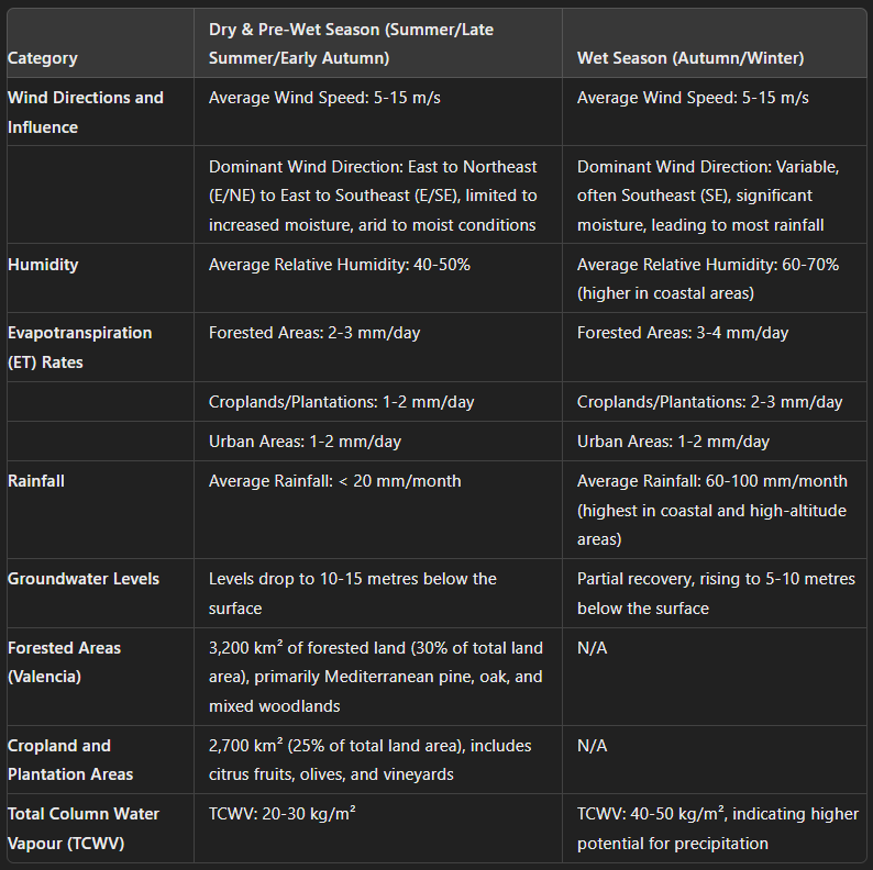
1. Wind Directions and Influence:
Dry Season (Summer)
Average Wind Speed: 5-10 m/s
Dominant Wind Direction: East to Northeast (E/NE), originating from the Mediterranean Sea, bringing limited moisture, contributing to generally arid conditions.
Pre-Wet Season (Late Summer/Early Autumn):
Average Wind Speed: 10-15 m/s
Dominant Wind Direction: East to Southeast (E/SE), carrying increased moisture as they begin to prepare the atmosphere for the wet season.
Wet Season (Autumn/Winter):
Average Wind Speed: 5-15 m/s
Dominant Wind Direction: Variable, often from the Southeast (SE), bringing in significant moisture, leading to the majority of annual rainfall.
2. Humidity
Dry Season: Average relative humidity of 40-50%.
Wet Season: Average relative humidity of 60-70%, with higher levels in coastal areas.
3. Evapotranspiration (ET) Rates:
Forested Areas: 3-4 mm/day during the wet season, reduced to 2-3 mm/day during the dry season.
Croplands/Plantations: 2-3 mm/day in the wet season, dropping to 1-2 mm/day in the dry season.
Urban Areas: Consistently low ET rates around 1-2 mm/day.
4. Rainfall:
Dry Season: Average rainfall of less than 20 mm/month, contributing to drought-like conditions.
Wet Season: Average rainfall of 60-100 mm/month, with coastal and high-altitude areas receiving the most precipitation.
5. Groundwater Levels:
Dry Season: Groundwater levels can drop to 10-15 meters below the surface in some regions, particularly in agricultural zones.
Wet Season: Partial recovery of groundwater levels, rising to within 5-10 meters of the surface, depending on the area and rainfall.
6. Forested Areas:
Valencia currently has approximately 3,200 km² of forested land, representing about 30% of the total land area. These forests are primarily composed of Mediterranean pine, oak, and mixed woodlands.
7. Cropland and Plantation Areas:
Cropland and plantations cover approximately 2,700 km², or 25% of the total land area. Key crops include citrus fruits, olives, and vineyards, with extensive use of irrigation to support agriculture during dry periods.
8. Total Column Water Vapour (TCWV):
Dry Season: TCWV values range from 15 ~ 30 kg/m², reflecting lower atmospheric moisture.
Wet Season: TCWV values increase to 40-50 kg/m², indicating higher potential for precipitation.
B- Proposed Interventions:
1. Forested Area Expansion
Target Increase: Expand forested areas by 640-2,000 km².
Suggested Locations
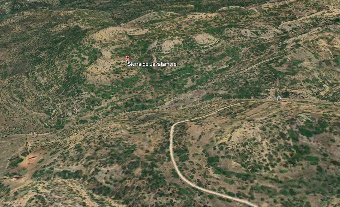
Sierra de Javalambre: 100-200 km².

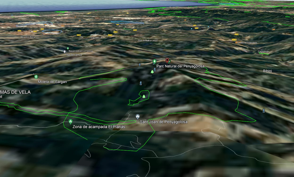
Peñagolosa: 80-150 km².
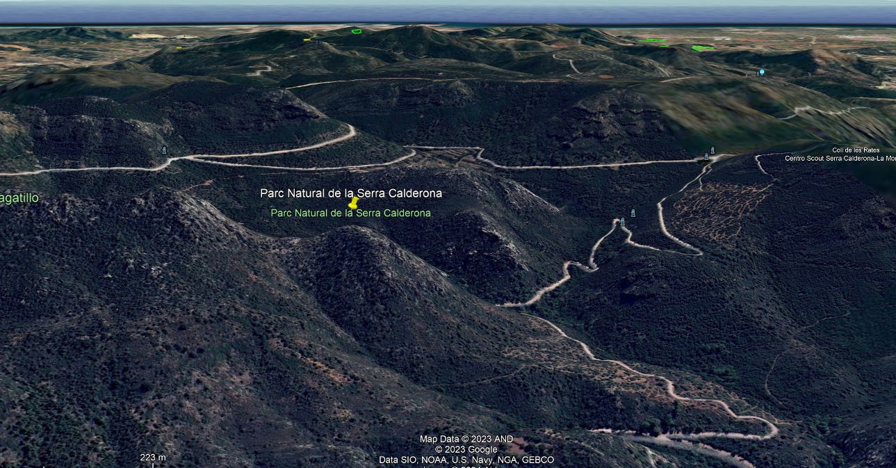
Sierra Calderona: 70-120 km².


Expected Impact: Enhanced orographic lifting, increased TCWV by 5-10 kg/m², and localized increases in rainfall, contributing to a 20-40% increase in regional bioprecipitation.
2. High-ET Plantation Expansion
Target Increase: Expand high-ET plantation areas by 270-800 km².
Suggested Locations:
Plana de Utiel-Requena: 60-120 km².
Ribera del Xúquer: 50-100 km².
Expected Impact: Increased ET rates contributing to higher atmospheric moisture levels and a 3-5 kg/m² increase in TCWV, supporting greater precipitation potential and a 15-30% increase in rainfall.
3. Marshes and Wetlands Restoration
Target Increase: Restore or create marshes and wetlands over 100-300 km².
Suggested Locations:
Albufera Natural Park and surrounding lowlands.
Expected Impact: Enhanced humidity levels, increased TCWV by 2-4 kg/m², and early onset of the wet season, contributing to a 10-20% increase in cloud formation and rainfall.
4. Coastal Forests Expansion
Target Increase: Expand coastal forests by 50-200 km².
Suggested Locations:
El Montgó: 50-100 km².
Serra Gelada: 50-100 km².
Expected Impact: Improved moisture capture from the Mediterranean Sea, leading to increased TCWV by 4-6 kg/m², and increased rainfall, particularly in coastal and adjacent inland areas.
5. Ponds and Water Bodies Introduction
Target Increase: Introduce or expand 50-200 small ponds totaling 50-100 km².
Suggested Locations:
Agricultural zones in Plana de Utiel-Requena and lower elevation areas.
Expected Impact: Increased local humidity and ET, supporting sustainable irrigation, a 2-4 kg/m² increase in TCWV, and enhancing local rainfall.
6. Rainwater Harvesting Systems (RWHS)
Target Catchment Area: Implement RWHS across 500-700 km².
Estimated Water Yield:
Catchment Efficiency: 75% efficiency, yielding approximately 225-300 million cubic meters of water annually.
Suggested Locations: Agricultural zones and lower elevation areas in Valencia, where the increased rainfall can be captured and stored effectively.
Expected Impact: Enhanced water security, complementing the increased rainfall due to higher TCWV and providing crucial water resources during dry seasons.
Expected Outcomes:
Bioprecipitation Increase:
20% Increase: Achieved with the expansion of 640 km² of forest, 270 km² of plantations, and the introduction of 100 km² of marshes, wetlands, and ponds, alongside increased TCWV.
30% Increase: Achieved with 1,000 km² of forest, 400 km² of plantations, and 150 km² of wetlands and water bodies, with significant TCWV improvements.
40% Increase: Achieved with 1,500 km² of forest, 600 km² of plantations, and 200-300 km² of wetlands and water bodies, driven by substantial increases in TCWV and optimized RWHS.
Biotic Pump Activation:
Effect from Year 4+ Onward: The biotic pump, activated by sustained increases in TCWV and enhanced forest cover, will further enhance the region's ability to draw in moisture, potentially adding an additional 10-20% increase in bioprecipitation.
Total Column Water Vapor (TCWV) Impact:
Baseline Improvement: The proposal expects to see an increase in TCWV by 5-10 kg/m² across targeted regions, directly influencing cloud formation and precipitation.
Disclaimer: The data presented in this proposal is based on extensive calculations using estimated average data. While these calculations provide a robust foundation for planning, they are based on generalized estimates. For more precise and targeted outcomes, a comprehensive analysis, including watershed analysis and detailed climate modeling, can be conducted if contracted. This proposal serves as a strategic guide to enhancing bioprecipitation in Valencia. Further refinement and validation with precise data will enhance its accuracy and effectiveness in achieving the desired outcomes.
C. Reverse Engineering the Calculations
With the proposal for Valencia laid out, the next step is to dive into the details.
How did I arrive at these numbers? Why did I choose these specific interventions?
In the following sections, I’ll reverse engineer the calculations, explaining the models and scientific principles behind each aspect of the proposal. I’ll walk you through the data collection process, the metrics considered, and how I determined the most effective strategies for boosting bioprecipitation and combating desertification in Valencia.